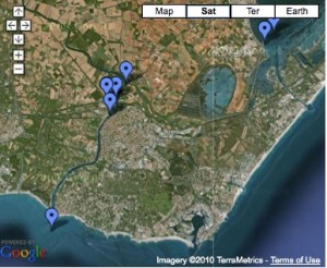
Google Canal View: Etang de Thau>Agde’s Circular Lock>Grau d’Agde
There is a route through the circular lock on the Canal du Midi at Agde for boats to get from the Etang de Thau to the Mediterranean coast at Grau d’Agde.
The unique circular lock at Agde has three gates. Two of the gates give access to the Canal du Midi for boats going downstream (on the left, to the Etang de Thau) and upstream (on the right, to Bezier). The third gateway (on the top) leads into a spur canal that runs south to join the Hérault River several hundred metres later. Following the Hérault downstream through the town of Agde leads into the Med after 2.5 kms at Grau d’Agde.
We were interested in this route from the Canal du Midi to the sea because it is the closest place to enter the Med for reaching Gruissan, 30 kms west along the coast, where we plan to moor Tempus Fugit over the winter. However, in planning for the trip, while we could find information about boats using this spur canal, we could not locate data on the clearances under the bridges across it. From initially viewing Google Earth and the historical diagram of the lock and the railway bridge half way down the spur it looked rather tight. But by using Google Earth along Google Street View and associated photographs we have been able to gauge the width and height clearances under the bridges and think we will be able to get through.


